Virtual Design Analysis Group is a division of NVentum, LLC.


-CAPTURING HISTORY-
This unique collaborative endeavor; to utilize the latest reality capture technology to document the artifacts, buildings and campus of History San Jose, provides opportunities for private sector, non-profits and institutions of higher education to work together to solve some of today's most pressing engineering issues. The protocol for retrofitting as-built historic facilities and the use of new technologies to preserve our most prized historic treasures are vital to the continued success and expanded influence of our museums.
This blog will document the challenges and successes of this ambitious, one of a kind project.

Tuesday, June 5, 2012

The Evolution of the Construction Industry


Tradition
 “Construction is a team sport, and BIM is dramatically reshaping the way project teams work together to increase productivity and improve outcomes for all. This is driving the most transformative evolution the construction industry has ever experienced.”…McGraw-Hill Construction SmartMarket Report, Design and Construction Intelligence, National Institute of Building Sciences

If you look at the construction and operation of facilities you can't help but realize that the techniques used today are virtually the same techniques that have been in use for centuries. Blueprints, floor plans and schematics have been the technology of choice for building homes, public facilities, schools and churches since the recording of history. Whether you are designing a home, selecting a hotel room, renting office space or building an addition to your current facility, the process begins with a basic 2D floor plan drawn on a piece of paper. Of course, innovations like CAD have made life easier but the basic format for designing or illustrating the dimensions, layout and design of a residential or public facility have remained unchanged.
While this process has been in use for centuries all over the world, it is not without it's problems. The construction field is synonymous with cost overruns, last minute changes in design and financial hurdles. Much of the cost are due to fragmentation during the construction phase. If you look at the construction process from start to finish, the gaps in the flow of information are obvious. Even so, there has been little effort to change the inefficiency has become embedded in the construction process. A typical construction project can have dozens of blueprints; each with different information specifically designed for different person/department. This fragmentation translates into cost that are eventually passed on to building owners. With these types of issues, why is the industry so slow to change?
"FIATECH" is an international community of passionate stakeholders working together to lead global development and adoption of innovative practices and technologies to realize the highest business value throughout the life cycle of capital assets...from the FIATECH website, www.fiatech.org
SJ City Hall
When our city leaders decided to build the new City Hall, the original cost estimates were approximately $214 million. Soon after, the cost estimate went to over $340 million; the final cost was approximately $382 million for the 55,000 square foot facility. The cost overruns can be attributed to several sources however a major factor in the increase in cost is labor; labor required to re-design, re-engineer, remove, re-deliver or re-order  parts or equipment that had to be changed at the construction site due to insufficient information. The electrician's blueprints don't have the plumber's schematic, notes or information. The plumber's blueprints don't have the HVAC plans. The carpenter's blueprints don't include the electrician's plans and so there are breaks in communication; the fragmentation within the process continues.
 Here's a typical example of what sometimes happens at construction sites; the HVAC contractor arrives at the construction site of a new office building to install a section of conduit on the third floor. Once on site, the HVAC contractor realizes there is an electrical tray in the path where the conduit was supposed to be installed. The HVAC contractor doesn't have this tray on his/her blueprints, so works stops while the contractor calls the office. After an hour of discussion(s), the contractor takes the pre-fab conduit back to the warehouse and the contractor re-designs the conduit to compensate for the electrical tray that was not included on their plans. Meanwhile, the HVAC installer, through no fault of their own, didn't accomplish the task scheduled for that day. The process of re-designing the HVAC system could set them back several days. Of course, the building owner is absorbing the cost for the entire process. This is just part of the business. There is nothing "shady" or unethical about this. No one is out to purposely run up the cost for owners and certainly no one wants to alienate a client. These things happen when you have several sub-contractors who each have a singular focus.
"The global capital projects industry, despite years of effort, is not achieving a level of interoperability exchanging models and data, or in process systems and tools that captures near the value opportunity to the industry stakeholders. Fiatech’s Vision Paper presents an overview of current industry activities for advancing interoperability, and puts forward building blocks with calls for action to accelerate advancement of interoperability to achieve step change value gains in the industry."...Comments on Interoperability From FIATECH website.
 However, it's not only the contractor and sub-contractors that contribute to the information gap. Owners and architects will sometimes make changes during project that require subcontractors re-design or re-work a given assignment. This creates more delays in work flow, which creates higher cost, which are passed on to the building owner.
 So, what can be done to correct these types of costly delays? Could a shared platform, accessible on a database or server, that provides all parties with real-time information, time-lines and updates be the answer? This is the role of the 3D model in the design and construction of buildings. 
 While I've written about the merits of this technology, the need for workforce development in the field(s) of BIM and VDC, the merging of BIM and GIS technology and so on, I am not the only person shouting about the importance of this technology nor am I the leading authority on these topics. This is not science fiction or a planned concept for the near future.This is today's technology. Some of the leading organizations and scholars and institutions of higher learning are deeply involved in 3D, BIM Technology and Virtual Design Construction.
Stanford University
Center For Integrated Facility Engineering- Stanford, CA.
The CIFE mission is to be the world's premier academic research center for Virtual Design and Construction of Architecture - Engineering - Construction (AEC) industry projects ... to support exceptionally reliable engineering and management practices to plan, design, construct and operate sustainable facilities...from the Stanford University CIFE website
 The question is, if this technology is such a major step in the evolution of construction, facility maintenance and operations, why aren't more industry leaders jumping on the bandwagon for 3D Modeling and BIM? The answer to that question isn't as easy as one might think. 
 The first thing that comes to mind today is the poor economic climate. This is always the quick and easy answer but in this case it doesn't apply. Apple Computer has recently began designing a $500 million campus. Apple  purchased an additional 98 acres in Cupertino for $300 million that used to be the old HP campus. A local hospital recently paid over $100 million dollars to create a 3D Model of their facility expansion. There is a new stadium under construction in Santa Clara. There are plans being made for an $800 million dollar stadium on the SF waterfront for the Warriors. There are many more large projects underway in and around Silicon Valley. Money is a problem for some but certainly not all and not among the big general contractors and architectural firms.
Green Building of the future
 Given the various projects underway in this region, why aren't more projects incorporating this cutting edge technology in the construction, maintenance and operations plan? I can tell you from our experience at NVentum, the challenges with introducing this particular technology has been a difficult but very interesting process. The real question we keep asking ourselves is, who will drive the need for BIM and 3D technology?

"The buildingSMART alliance™ is a unique organization helping to make the North American real property industry more efficient by leading the creation of tools and standards that allow projects to be built electronically before they are built physically using Building Information Modeling."..from the Building Smart Alliance websitea council of the National institute of Building Sciences.
 Many of the architects we've met and worked with have an interest in 3D modeling and BIM technology. Most use VDC to create models for their presentations. However, the creating a 3D model of an as-built facility or of a facility under construction is something done in the field. Though there is tremendous benefit to have a 3D model of a facility, this is not something architects do. This makes it unlikely that architects would be the driving force behind this new technology.

From my perspective, labor unions were the obvious answer to this question; who better to drive this new technology? Unions are responsible for keeping their members informed and educated in the latest skills and techniques in their area of expertise. Training their members would assist in insuring future employment for the coming economic wave. This is a no-brainer, right? Not so fast, we spent years trying to get local unions to look into this technology and create training curriculum and opportunities for members. In most cases, senior membership struggled with the concept of moving away from techniques they've been practicing their entire careers. One long-time union member said it best, "I'm retiring in three years. Why would I want to relearn how to do my job now?" This wasn't the sentiment of all unions, however. Others were supportive of the concept but reluctant to spend money on expensive equipment and training cost when union dues are down due to the economy. It is unlikely that a push for new technology in the construction field(s) will come from labor unions.
Centuries Old Technique
 Many of the big general contractors are fully aware of the technology and the various applications. Several have BIM coordinators/managers on staff or under contract for specific projects. However, general contractors are in the business of providing bids for jobs. Anything is not deemed critical yet adds to the cost of a bid is a liability. While most Bay Area cities have green building ordinances, none require 3D/BIM technology Most green building codes refer to LEED standards and none address as-built building unless the facility(s) being re-modeled. It is unlikely that general contractors will become the driving force behind this push for technology.
According to the U.S. Green Building Council, CO2 emissions from commercial buildings are predicted to grow at about 1.8 percent annually through 2030, faster than any other sector of the economy. If 50% of new commercial buildings are built to use 50% less energy, more than 6 million metric tons of C)2 would be saved annually for the life of the facility, 50 to 100 years.
 Though the cost of construction can be very high, it is the cost of maintaining and operating a facility through it's life cycle that is most costly. The cost of power, water, maintenance and upkeep is where the majority of the owner's investment lays. Having the ability to monitor and adjust energy consumption, reduce maintenance cost through prevention and scheduling,  to reduce the carbon footprint of the facility, increase employee health and productivity by monitoring and correcting air quality and contaminant, increase overall productivity by reducing response and repair times by contractors; these are the real benefits to 3D/BIM technology. The real key to the widespread implementation of these innovative technologies is the education of building owners. It is the building owners who will set the demand for this new technology. The building owners who will begin the revolution in workforce development and set in motion the evolution of the construction industry. When building owners start to require 3D Models and BIM technology in the bid process, that's when you will see architects, contractors and unions rushing to recruit people with BIM experience and  looking for training opportunities for employees and members. It all starts with the building owners, the people who bare the cost and therefore have the most at stake. 
"Proper Building Information Management (BIM) technology can have a major impact on the health and productivity of our community. Existing SMART technologies and procedures can improve Indoor Environmental Quality (IEQ) in a manner that significantly increases employee productivity and health According to an August 2000 report from the Environmental Energy Technologies Division of the Lawrence Berkeley National Laboratory, the estimated potential savings and productivity gains in the U.S. alone are $6 Billion to $14 Billion from reduced respiratory disease, $2 to $4 billion from reduced allergies and $20 to $160 Billion from direct improvement in worker performance related to health."...http://www.osha.gov/SLTC/indoorairquality/index.html

Today's "Blueprints"
Laser Scan of HSJ Trolley Barn
by Ken Hanna, NVentum, LLC.


Monday, May 14, 2012

Making The Case For Historic Documentation

"Historic preservation can -and should- be an important component of any effort to promote sustainable development. The conservation and improvement of our existing built resources, including re-use of historic and older buildings, greening the existing building stock and re-investment in older historic communities is crucial to combating climate change..." Preservation Nation.org

SAN JOSE'S RICH HISTORY
California's First Civilian Settlement- November 29, 1777
California's First State Capital- 1849-1852
California's First Incorporated City- March 27, 1850

San Jose is the third largest city in California and the tenth largest city in the country. Founded in November 1777, El Pueblo de San Jose de Guadalupe was the first civilian town in the Spanish territory of Nueva California. The settlement served as a farming community to support military installations at Monterey and San Francisco, CA. Historic places help define and distinguish our communities by creating a strong sense of identity; understanding our heritage, connecting the stories of past generations to the experiences of today. 

Old Chinatown
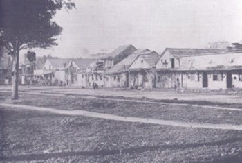
(East side of Market Street, from San Fernando to San Carlos Streets)From 1872 to 1887 a large Chinese population lived and prospered in this area. By the late 1800's, downtown businesses were expanding and many of the business leaders wanted to relocate Chinatown. In 1887, after several unsuccessful attempts at relocation, a mysterious fire tore through Chinatown's wooden and brick structures. Within a matter of hours, the entire community was wiped off the map. This historic marker is the last reminder of the community and the people of old Chinatown.

Rare Photo of Old Chinatown
cir.1880/View From Market Street


The Donner-Houghton House
The Donner-Houghton House was built by Sherman Otis Houghton, a well known attorney and politician and in 1881. A former mayor f San Jose, Deputy Clerk of the California Supreme Court and Commissioner of the US Mint at San Francisco, in 1859, Mr. Houghton married Mary Martha Donner a survivor of the Donner Party. 
Donner-Houghton Mansion 2006
The Donner-Houghton home was placed on the National Register of Historic Places in 2002. Plans were being made to move the home to the San Jose History Park.
On the morning of July 9, 2007, the home was almost completely destroyed  by fire.
Donner-Houghton Mansion- July 2007
The Kelley House
Original Kelley House Elevation
at San Jose's Kelley Park
The 5600 Square Foot Kelley House was built in 1912 and was the last historical structure associated with the Kelley Family. The property was once owned by Louise Kelley who inherited it from her father, former San Jose mayor, Lawrence Archer.The 160 acre property was originally named "Lone Oak" was purchased in 1861. The original house burned to the ground in 
1909. The new home was built in the same location in 1910. In 1951, Louise Archer Flavin Kelley sold the house and 63 acres to the City of San Jose for use as a public park, on the condition she be allowed to live in the family home for the rest of her life. She died six months later in February 1952 at the age of 89. 
Kelley Fire 


Kelley House Fire
February 2012
In February 2012, the Kelley House was destroyed by fire. Estimates to restore the home to historic conditions are from $6 to $8 million.

IBM Building #25
IBM Building 25
When IBM erected the Advance Research Building number 25 in 1957, it was the symbol of Silicon Valley innovation. The building was developed to house IBM's top data-storage, who made history with the development of the flying head disc drive. The data technology allowed for online transaction processing, which companies like American Airlines used for real-time reservation systems. In 1958, Factory-Maintenance and management named the building "Plant of The Year" out of 900 sites. The Historic Landmarks Commission named this site is "one of the finest examples of Modern Industrial architecture in Santa Clara County". 
IBM's Historic Building #25
Destroyed by Fire March 2008

The documentation of historic architecture provides insight into the artistry, craftsmanship, culture and technology of our forefathers. Understanding the techniques and technology of the past helps pave the way for the innovations of today and tomorrow. Modern cutting edge sustainable construction technology, the efforts to reduce the carbon footprint of capital facilities and the emergence of LEED technology have their roots in the study of our historic architecture.


For more information on iconic Silicon Valley Architecture, 
Visit our Silicon Valley Blog at www.virtualdesignanalysissiliconvalley.blogspot.com


Tuesday, May 8, 2012

Clarifying BIM

What is BUILDING INFORMATION MODELING?
 The National Institute of Building Sciences defines BIM as
 Building Information Modeling (BIM) utilizes cutting edge digital technology to establish a computable representation of all the physical and functional characteristics of a facility and its related project/life-cycle information, and it is intended to be a repository of information for the facility owner/operator to use and maintain throughout the life-cycle of a facility.

In simple English, BIM technology uses a 3D model as a data base for information about the building and all operating systems; environmental, security, MEP, etc.. The diagram below, courtesy of AEC Infosystems Inc., gives an excellent example of BIM technology. As you can see, the image of the door and door frame have pop-up categories with room for myriad information about the door, the frame and hardware. The information can be retrieved for use at any time and can be altered, changed or edited by the administrator/primary user(s) as necessary.
Detailed examination of the diagram provides insight into the type of information that can be stored and retrieved from a 3D model. The information from the model can be used for operations, planning,  construction, facility retrofits and as-built documentation.
Facility owners can conduct a variety of simulations utilizing the information stored within the 3D model. For example, the diagram above contains a significant amount of information about the construction of the door. In addition to the dimensions of the door, the diagram includes the door's fire rating, acoustical rating, glass inserts, heat transfer rate, etc. This vital information can be used to create a variety of simulations that can help a facility owner decide what types of changes, retrofits or upgrades would provide the best results for the long term operation of a facility. Acoustical simulations, energy simulations, heat transfer simulations can all be conducted within the 3D model. The facility owner/operator can exchange the door in the virtual world, replacing it with a door that has different fire rating, heat transfer rating, different type of glass inserts and conduct simulations for sound, air flow and energy usage. Simulations like these can help facility owner/operators develop strategies to reduce operational cost.
Air contaminants are a critical concern for museums. The quality of the air, the flow, moisture and circulation can have a major impact on exhibits, especially historic items. The ability to test the quality of the air and its impact on the museum environment is crucial to the long term survival of historic artifacts. BIM technology holds the answers to the problems that all museums struggle to address.
Given the detailed information included in the diagram above, imagine what type of information can be included in an entire building that incorporates BIM technology. Windows, doors, walls, ceilings, floors, mechanical systems, electrical systems, plumbing, roofing, landscaping, there is no  aspect of a building that cannot benefit from the inclusion of BIM technology.

Tuesday, May 1, 2012

Documenting Historic Sites


Laser scanning is not an untested technology when it comes to the documentation of archaeological sites. There are currently dozens and dozens of preservation projects underway around world utilizing laser scanning technology to capture and store data. Organizations like the Center For Advance Spatial Technologies, CyARK and Universities from all over the world are working with lasers and 3D models to document and preserve historic structures and sites for future generations.

Here are just some of the historic preservation projects currently underway around the world:

CAST Projects
(Center For Advance Spatial Technologies)
Project: Laser scanning of Machu Picchu, Peru. A UNESCO World Heritage Site
Organization: Center For Advance Spatial Technologies w/University of California Los Angeles' Cotson Institute for Archaeology. "Computer Modeling of Heritage Resources Field Program" 

Project: Prairie Grove Battlefield State Park, Historic Civil War Site
Organization: Center For Advance Spatial Technologies- University
of Arkansas Honors College


Project: "Visualizing The Roman City: Ostia Antica"
Organization: Center For Advance Spatial Technologies w/ University
of Arkansas Honors College


CyARK Preservation Projects


Church of Sao Francisco
Church of Sao Francisco- Bahia Brazil, 1538
Mt. Rushmore- South Dakota
Medieval Bridge at Regensburg Germany
The Presidio of San Francisco
The Cathedral of Beauvais, Beauvais France
Ruins at Chichen Itza, Mexico
The Ramesseum at Ancient Thebes, Egypt
Deadwood, South Dakota
Temple at Angkor, Cambodia
The Ruins at Pompeii
Mesa Verde Ruins
Roman Baths, Weibenburg, Bavaria
Rapa Nui- Easter Island Monolith
Qal' at al-Bahrain- (14th Century Portuguese Fort)
Mesa Verde National Park, Colorado...(in collaboration w/Texas Tech University, UC Berkeley and National Park Service)


Chichen Itza-
 Mayan Ruins


Chichen Laser Scan


These are just some of the historic preservation projects currently underway around the world that are utilizing laser scanning technology for documentation purposes. Given the number and the extent of the historic documentation projects listed above, what makes "Capturing History" such a unique project? What is History San Jose, NVentum LLC. and Evergreen Valley College doing that sets this project apart from all others?

Pasetta House
Laser Scan by Ken Hanna, NVentum, LLC.

The Difference is BIM
Capturing History utilizes laser technology as the foundation of our project in the same manner as other documentation projects. Laser scanning provides fast accurate documentation for condition monitoring, preservation, clash detection and virtual reconstruction. However, this is just scratching the surface of what this technology can be used for. As mentioned in many of my previous post, one of the major objectives of this project is to create a BIM model of the historic buildings and the History Park' s 14 acre campus.
Blacksmith's Shed and Trolley Barn
Laser Scan by Ken Hanna, NVentum, LLC

A complete BIM model of the HSJ campus and facilities will provide a shared platform for the day to day maintenance, management and operations of the museum.
Operations staff will use the 3D model for virtual expansion of the park grounds, to monitor mechanical systems, plan/install sustainable energy upgrades, conduct facility performance simulations, or to schedule maintenance and repairs.
Administrative staff will use the 3D model as a project calendar and to schedule events
Marketing staff will use the model as a sales tool, a data base and/or online exhibit.
Pasetta House
Scan by Ken Hanna
Safety/Security staff will use the 3D model to monitor the museum's assets, emergency planning, traffic control, fire inspection/permits, seismic monitoring/retrofits, etc.

The Capturing History project answers the question, "what now?... Now that I have this 3D model, what can I do with it?"

Pasetta House
Pasetta Porch/Entrance


Sunday, April 22, 2012

GEMS AT THE MUSEUM

LEFEBVRE VELOCIPEDE

Alexander Lefebvre of Saint-Denis, France is credited with building the world's first two wheel velocipede powered by treadles connected to cranks on the rear wheels in 1842. He brought the bicycle to California when he immigrated twenty years later. 
The Lefebvre Bicycle is the oldest bicycle of its' kind in existence and it currently resides at the San Jose History Museum.

Lefebvre Bicycle Images Courtesy Of 

Raw Laser Scan by Ken Hanna, NVentum, LLC.

Unrestored, The  Originial Lefebvre Velocipede Lives at History San Jose's Collection Center
Laser scanning and 3D documentation provides owners, curators and operators with highly detailed information about the construction and condition of the artifact. The laser scans contain exact dimensions and measurements of all the artifacts' components. Scanning the artifact prior to restoration provides a platform for virtual restoration as well as a 3D schematic for reference

Laser Scans by Ken Hanna, NVentum, LLC.

Laser Scans by Ken Hanna, NVentum, LLC. 


Laser Scans by Ken Hanna, NVentum, LLC. 

Laser Scans by Ken Hanna, NVentum, LLC. 


Laser Scan by Ken Hanna


Photo Courtesy of History San Jose
Laser Scan by Ken Hanna, NVentum, LLC.


Monday, April 16, 2012

Historic Trolley Barn


Trolley Barn at San Jose's History Park
Earlier blog entries addressed the concerns about the limitations of laser scanning for historic documentation. One of the most glaring examples of the limits of this technology is the problems encountered when scanning non reflective objects.

Interior Laser Scan of HSJ Trolley Barn
NVentum, LLC.
Lasers capture the light reflected off of the object being scanned. Objects and colors that absorb light are difficult, if not impossible to capture clearly. This was clearly demonstrated during our initial scans of the interior of History San Jose's Historic Trolley Barn.

The Trolley Barn was built in 1984 as a place to restore and house historic trains and trolley cars. In addition to the trains and trolley cars, the barn also houses historic automobiles and old factory machinery.

At first glance, the preliminary laser scans of the interior of the barn provide the viewer with a great amount of detail. The details of the signage in the back ground, the outline and the detail of the 1913 Metz in the foreground are promising images and a great start to the project.
1913 Metz- HSJ Trolley Barn
Laser Scan by NVentum , LLC.

As we continued our process, the concerns moved from the laser capture process to texture mapping. How would the photo overlay work against a laser scan with so many non-reflective objects? The automobiles, the trains and much of the machinery had major elements that were finished in black or flat black. However, this 1913 Metz was finished in a very dark blue and the laser scans showed great promise.


Classic Autos- HSJ Trolley Barn
As you can see by the scan on the right, the two classic automobiles were captured very clearly in the laser scan, or so it appears. The automobile in the foreground is dark blue in color. The automobile in the background is very dark blue with black fenders. Understanding the laser's limitations, I was pleased with the initial images. However, the images that you see in this still photo are deceiving. What clearly appears as two dark colored antique automobiles is actually an illusion. The areas of the vehicles that appear black are actually areas of the scan that are devoid of all information. The laser was unable to capture any data at all, it is literally a "hole" in the scan. One of the main benefits of laser scanning technology is the ability to store and extract information from the model. While the scans of the automobiles appear to have quality information, the lack of data in this scan means the user is unable to gather critical details about the vehicles; its dimensions, the condition of the body, finish and metal. Though, at first glance this technology appears to be the perfect documentation tool.


History San Jose- Trolley Barn Machinery
Laser Scan by NVentum, LLC.
 This "mass" of equipment to the left is actually an amazing collection of antique machines and equipment used in factories at the turn of the century. The majority of these machines are finished in either black or flat black. As you can see from the scan, much of the detail of the machines is missing or indecipherable. There are gears, pulleys, drills and a host of belts and levers that were not picked up by the laser and cannot be seen clearly in this scan. Looking at the scan from other angles reveals a void of information similar to the scans of the automobiles.

The scan below was actually taken from a 360 degree scan of the 1913 Metz above. This is the Historic Trolley #124 that is still in use at the San Jose History Park.
History San Jose's Trolley No.124
Laser Scan by NVentum, LLC.
Trolley No.124
Photo Courtesy of History San Jose

Future blog post will document the reality capture and mapping of the Historic Pasetta  House located on the campus of the San Jose History Park. The goal is to feature the Pasetta House as the museum's first extensive BIM structure and data based model exhibit. Stay tuned for new blog post, updates and unique solutions to the challenges of  "Capturing History"

Sunday, April 1, 2012

The Pasetta Project

Laser Scan and Texture Mapping by Ken Hanna, NVentum, LLC.
To the untrained eye, the difference between a high definition photo and a laser scan can very difficult to recognize. Given the quality of today's high definition photos, some may ask the question, "why laser scan at all?".

While high def photos can provide outstanding clarity of details and extremely crisp colors, the benefits of the laser scans lays its ability to collect and store massive amounts of data.
3D Model As A Data Base
What type of data are we talking about? Let's start with the "visible" data contained in this preliminary scan of one of the interior rooms of the historic Pasetta House located at the San Jose History Park.
The visible data contained within this scan can range from the general to the extremely detailed;
based upon the needs of the user. Details such as:
  1. The manufacturer, distributor and color code of the paint on the walls and ceilings. 
  2. The type of wood and stain used to construct the floors, trim around the windows and room. 
  3. Information about the lighting fixtures; the manufacturer, date of purchase and installation,  the wattage and power usage.
  4. The artwork on the walls; the creation date, the artist, the lender/owners, the materials and/or process used to create the piece(s), etc.
  5. The manufacturer, cost, date of purchase of the antique area rug.
  6. Location and number of wall outlets
  7. Location of floor vents along with manufacturers information
Photo Courtesy of History San Jose


What about the "invisible" data contained within the laser scan; critical data that can be used to help monitor and reduce carbon emissions, reduce operating cost and minimize costly repairs through managed preventive maintenance. 


Laser Scan/Texture map by Ken Hanna
  1. Mechanical information: Heating, Ventilation and Air Conditioning components
  2. Plumbing and piping information
  3. Electrical/wiring systems
  4. Ceiling/wall insulation materials
  5. Air Flow/air contaminant monitoring sensors
  6. Humidity monitoring sensors
  7. Energy auditing systems
  8. Detailed dimensions of the room and measurement capabilities
  9. Emergency response systems; fire suppression, security, etc.
The wealth of information contained in the 3D model can be used to manage the day to day operations of the park, conduct long-range strategic planning, to create unique online exhibits,  create site maps for specific events and/or projects, conduct and manage major construction projects, remodeling and retrofitting of specific historic buildings, control and manage museum assets and inventory, reduce energy consumption, design campus upgrades and most anything else the facility operators, owner and/or guest require.

A quick glance at the preliminary scans in this blog post reveals a couple of unique features that immediately grab the viewers attention. First and most noticeable is the large black circle or "hole" in the center of the floor of the room. This spot represents the space occupied by the laser during the scanning process. If you've read any of the previous post on this blog, you'll recall that the laser scans an area that is 360 degrees x 270 degrees. The 90 degrees not covered by the initial scan is actually the area directly beneath the scanner. This black spot or "hole" in the scan is easily remedied by conducting a second scan from another location within the room and combining or"stitching" the two scans together to create the model.

The second thing that you'll notice is the color coded X, Y, and Z coordinates located within the scan. These coordinates usually represent the camera/laser's position and is relative to where you are viewing from. Typically, these coordinates are just a length in a direction; X= side to side, Y= up and down and Z= near and far. Without getting too complicated, the floating point number is a distance in 3D space relative to the origin. (Zero, Zero, Zero)
Laser Scan/Texture Mapping by Ken Hanna, NVentum, LLC.
The purpose of the Pasetta Project is to create an as-built model of the building that will serve several purposes. First, the laser scans conducted by NVentum, LLC.will serve as the "blueprint" of this historic home. Secondly, the 3D model will be adapted to serve as an online exhibit for guest and visitors to the museum. Lastly, our long range plan is to use the Pasetta House to establish the protocol for historic documentation and sustainable energy upgrades for as-built facilities and museums.

Saturday, December 17, 2011

The Relevance of "Capturing History"


              Green Building Standards
The "Capturing History" project is comprised of several important components; each brings it's own unique contribution to the museum's life cycle management and operations plan.  Whether the emphasis is on indoor environmental quality, preservation, condition monitoring, energy conservation, virtual design, asset management or BIM the project cannot move forward without the reality capture, laser scanning and surveying of the campus. The 3D model is the data base and  hub for each and every aspect of the project.
San Jose City Hall
 Though each component of the project has its importance, new green building regulations and future legislation towards sustainable construction can't be overstated. Many communities have adopted green building standards aimed at new construction. Eventually, these regulations will be extended to affect building remodels and retrofits. 
 Those individuals looking to enter the workforce will need knowledge and training in disciplines that embrace sustainability, energy efficiency, environmental stewardship and conservation; all major components of the "Capturing History" project. 
Here is an example of the trend towards green building standards and the importance of this project's BIM/sustainable energy component:
From the webpage of the US Green Building Council- Northern California Chapter:
Out of 109 cities and counties throughout the Bay Area: 
• Most cities and counties began adopting required green building standards starting in
2006.
• Forty-four cities and counties have adopted required new commercial green building
standards and nearly all of them are based on the LEED rating system.
• Fifty-one cities and counties have adopted required new residential green building
standards and all of them are based on the Build It Green rating system.
• Local approaches to standards typically require higher standards for larger buildings
and more flexibility for smaller buildings.
New Commercial Construction
• Thirty-nine cities have adopted their green building standard based on the LEED rating
system for new commercial construction. For projects greater than 30,000 square feet,
24 of those cities require a LEED rating level such as Certified, Silver or Gold, while the
other 15 cities at least require a LEED checklist.
• LEED Silver is the most frequently used level and LEED Certified is also common.  San Francisco  Oakland  San Jose  California Energy
Commission
New Residential Construction
• Forty-six cities have adopted green building standards, all based on the Build It Green
rating system. Thirty-seven require Green Point Rated and nine of them only require
completion of the Build It Green Checklist.
• Twenty-three cities require a minimum of 50 points  for new residential construction.
This is the most common level among Bay Area cities for new residential construction.
• Fourteen cities require more than 50 points, in which the most common range lies
between 60 - 90 points. San Rafael, San Anselmo and Rohnert Park, require in between
75 – 200 points depending on the threshold.    
• A few cities offer the option of using LEED for Homes certification as an alternative to
the Build It Green rating system.                                                                                                                                                                                                                          
Oakland City Hall
Other Findings
• Forty-two cities and counties require a LEED rating level, such as Certified, Silver or Gold
for new municipal construction.
• Twenty cities and counties require a LEED rating level or checklist for commercial
remodels or renovation projects depending on the project size or valuation. On the
SF City Hall
other hand, six cities require a minimum number of points in the LEED Checklist (usually
ranging from 10 – 35 points).
• Twenty-two cities and counties require 25 – 50 points Green Points Rated for existing
residential buildings depending on the project size or valuation on either the Elements
or Whole-House Build It Green Checklist.